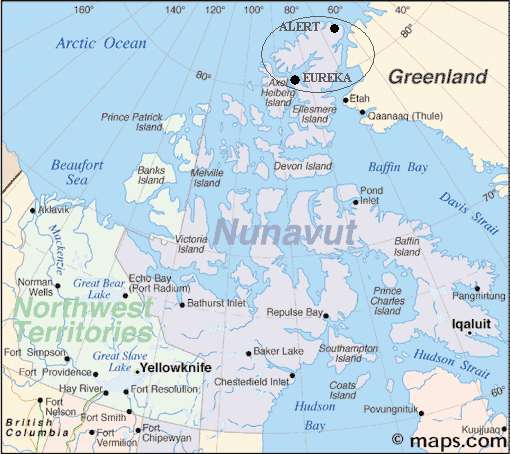
This Arctic field trip was based out of Eureka, which is a weather station on north-east Ellesmere Island (800 13'N, 860 11'W). It lasted from 23 March to 24 April, 2008. It was similar to 2006 field trip in that it was an investigation of a section of the Arctic-Ocean bottom. In 2006 the Canadians and the Danes investigated the Lomonosov Ridge; this year we investigated the Alpha Ridge without the assistance of the Danes. The Alpha Ridge is so far west of Greenland that the Danes have no strong interest in it. Also, since the area of interest is so far west, Eureka is much more suitable than Alert as a base of operations.
The scientists learn much about the under-sea geology by setting off explosions in the water and looking at the acoustic reflections from the layers in the earth's crust.

The Canadian agency doing this work was the Geological Survey of Canada (GSC), which is a part of Natural Resources Canada (NRCan).
Return from the pdf files with your "back button".
Newsletter 1